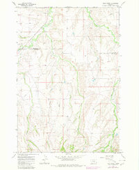
1967 Map of Deep Creek
USGS Topo · Published 1980About this map
Pryor Creek and Deep Creek carve through the high plains of the Crow Reservation boundary, where the line between Yellowstone and Big Horn counties meets. The landscape is defined by its drainage network, featuring uniquely named watercourses such as Smallpox Creek, Porcupine Creek, and the seasonal flow of Fourth of July Creek. A small Cem and a nearby Claypit near the northern boundary indicate localized historical activity, while a prominent Pipeline corridor cuts across the northern ridges. This 1967 survey, with revisions added in 1980, captures a rugged transition of the Montana range before modern development, marking the confluence of several essential creek systems including Hay Creek and Cottonwood Creek.
Find a feature on this map
13 named features on this map. Tap any name to fly to it.
Don’t see what you’re looking for? This feature index may not catch every label — zoom into the map to look around manually.
Map Details
Editions of this 1967 Deep Creek Map
3 editions found
Other maps of this area

1893 · Huntley
USGS Topo · 1:125,000

1954 · Billings
USGS Topo · 1:250,000

1957 · Billings
USGS Topo · 1:250,000

1958 · Billings
USGS Topo · 1:250,000

1967 · Deep Creek SE
USGS Topo · 1:24,000

1967 · Castle Rocks
USGS Topo · 1:24,000

1967 · Deep Creek
USGS Topo · 1:24,000

1967 · Pryor
USGS Topo · 1:24,000

1967 · Deep Creek SW
USGS Topo · 1:24,000

1967 · Soda Springs
USGS Topo · 1:24,000