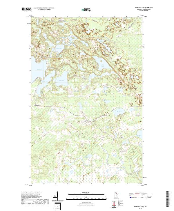
2022 Map of Deer Lake East
USGS Topo · Published 2022About this map
Five Island Lake and the northeastern reaches of Deer Lake define this northern Minnesota landscape, where a dense network of water bodies and marshland sits within the Bigfork River watershed. The terrain is characterized by a high concentration of glacial lakes, including the uniquely named Lake Seventeen and Pighole Lake, connected by a web of forest trails and county roads. The transport network reflects the area's recreational and timber heritage, with named routes like Horseshoe Forest Trl, Thistledew Trl, and the evocatively named Roller Coaster Rd winding between the shorelines.
Find a feature on this map
53 named features on this map. Tap any name to fly to it.
Don’t see what you’re looking for? This feature index may not catch every label — zoom into the map to look around manually.
Map Details
Editions of this 2022 Deer Lake East Map
This is the sole edition of this map. No revisions or reprints were ever made.
Other maps of this area

1919 · Release
USGS Topo · 1:62,500

1943 · Release
USGS Topo · 1:62,500

1954 · Hibbing
USGS Topo · 1:250,000

1957 · Hibbing
USGS Topo · 1:250,000

1958 · Hibbing
USGS Topo · 1:250,000

1964 · Hibbing
USGS Topo · 1:250,000

1964 · Sherry Lake
USGS Topo · 1:24,000

1970 · Rauch
USGS Topo · 1:24,000

1970 · Deer Lake East
USGS Topo · 1:24,000
1970 · Anderson Lake
USGS Topo · 1:24,000