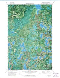
1970 Map of Anderson Lake
USGS Topo · Published 1973About this map
George Washington State Forest dominates this topographic orthophotomap, revealing a dense network of glacial lakes and wetlands in northern Minnesota. Unlike traditional line-drawn maps, this 1970 study uses aerial photography to depict the actual vegetation and shoreline conditions of the era. The terrain is marked by a complex system of waterways, including the sprawling Anderson Lake and the high vantage point provided by the Link Lake Lookout Tower.
Find a feature on this map
32 named features on this map. Tap any name to fly to it.
Don’t see what you’re looking for? This feature index may not catch every label — zoom into the map to look around manually.
Map Details
Editions of this 1970 Anderson Lake Map
2 editions found
Other maps of this area

1919 · Release
USGS Topo · 1:62,500

1919 · Marcell
USGS Topo · 1:62,500

1943 · Release
USGS Topo · 1:62,500

1954 · Hibbing
USGS Topo · 1:250,000

1957 · Hibbing
USGS Topo · 1:250,000

1958 · Hibbing
USGS Topo · 1:250,000

1964 · Hibbing
USGS Topo · 1:250,000

1970 · Clubhouse Lake
USGS Topo · 1:24,000

1970 · Coon Lake
USGS Topo · 1:24,000

1970 · Deer Lake East
USGS Topo · 1:24,000