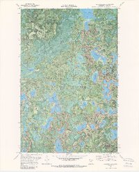
1970 Map of Anderson Lake
USGS Topo · Published 1989About this map
The George Washington State Forest dominates this landscape of the northern woods, characterized by a dense network of glacial lakes and wetlands. This 1970 field-checked survey reveals an area primarily utilized for timber and outdoor recreation, with multiple campgrounds and a visible Winter Rail Trail cutting through the forest. The presence of the Link Lake Lookout Tower and the Old Scenic Ch suggests a sparsely populated region where social life and safety were tied to specific, widely spaced landmarks.
Find a feature on this map
33 named features on this map. Tap any name to fly to it.
Don’t see what you’re looking for? This feature index may not catch every label — zoom into the map to look around manually.
Map Details
Editions of this 1970 Anderson Lake Map
2 editions found
Other maps of this area

1919 · Release
USGS Topo · 1:62,500

1919 · Marcell
USGS Topo · 1:62,500

1943 · Release
USGS Topo · 1:62,500

1954 · Hibbing
USGS Topo · 1:250,000

1957 · Hibbing
USGS Topo · 1:250,000

1958 · Hibbing
USGS Topo · 1:250,000

1964 · Hibbing
USGS Topo · 1:250,000

1970 · Clubhouse Lake
USGS Topo · 1:24,000

1970 · Coon Lake
USGS Topo · 1:24,000

1970 · Deer Lake East
USGS Topo · 1:24,000