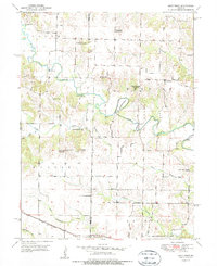
1951 Map of Deer Ridge
USGS Topo · Published 1953About this map
The Middle Fabius River carves a winding path through the northern landscape of Lewis County, forming the prominent Horseshoe Bend as it flows eastward. This early 1950s survey documents a rural Missouri landscape defined by small-scale crossroads communities like Forest Springs and Deer Ridge. The mapping reveals a high density of rural schoolhouses, many already designated as Union Sch or Banner Sch, indicating a shift in educational consolidation during the mid-century. Transportation is anchored by the Chicago Burlington and Quincy railroad line cutting across the southwestern corner, while local crossings like Parrish Bridge and Seaman Bridge connect the ridges divided by Brushy Creek and other tributaries. Family and community heritage is grounded in sites like Bondurant Cem, Mt Salem Ch, and Mt Pleasant Cem, which remain as fixed points in the shifting agricultural terrain.
Find a feature on this map
34 named features on this map. Tap any name to fly to it.
Don’t see what you’re looking for? This feature index may not catch every label — zoom into the map to look around manually.
Map Details
Editions of this 1951 Deer Ridge Map
3 editions found
Other maps of this area

1903 · Kahoka
USGS Topo · 1:125,000

1903 · Edina
USGS Topo · 1:125,000

1950 · Neeper
USGS Topo · 1:24,000

1950 · Williamstown
USGS Topo · 1:24,000

1950 · Lewistown
USGS Topo · 1:24,000

1950 · Colony
USGS Topo · 1:24,000

1950 · La Belle
USGS Topo · 1:24,000

1951 · La Belle
USGS Topo · 1:24,000

1951 · Colony
USGS Topo · 1:24,000

1951 · Neeper
USGS Topo · 1:24,000