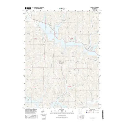
2016 Map of Deersville
USGS Topo · Published 2016About this map
Tappan Lake and Clendening Lake dominate this Harrison County landscape, their intricate shorelines carved into numerous inlets like Wye Bay, Bontrager Bay, and Deersville Bay. The small settlement of Deersville sits on the high ground between these two large reservoirs, serving as a central point for the surrounding rural road network. The map reveals a high density of burial sites important to local genealogy, including the Deersville Methodist Episcopal Cem and the Minksville Cem to the southeast. Historically significant routes like the Moravian Trl Rd and Cadiz Dennison Rd traverse the hills, connecting the village to the water's edge at Tappan. Small watercourses such as Beaverdam Run and McFadden Run drain the wooded valleys, illustrating the complex hydrology that feeds the region's managed lakes.
Find a feature on this map
103 named features on this map. Tap any name to fly to it.
Don’t see what you’re looking for? This feature index may not catch every label — zoom into the map to look around manually.
Map Details
Editions of this 2016 Deersville Map
This is the sole edition of this map. No revisions or reprints were ever made.
Other maps of this area

1902 · Scio
USGS Topo · 1:62,500

1903 · Flushing
USGS Topo · 1:62,500

1904 · Scio
USGS Topo · 1:62,500

1905 · Flushing
USGS Topo · 1:62,500

1909 · Antrim
USGS Topo · 1:48,000

1909 · Uhrichsville
USGS Topo · 1:62,500

1911 · Antrim
USGS Topo · 1:62,500

1911 · Uhrichsville
USGS Topo · 1:62,500

1951 · Canton
USGS Topo · 1:250,000

1953 · Canton
USGS Topo · 1:250,000