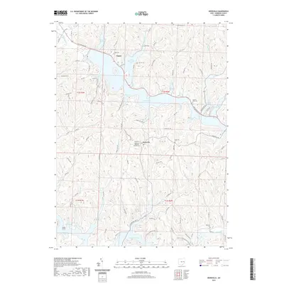
2019 Map of Deersville
USGS Topo · Published 2019About this map
Deersville serves as a central hub in this Harrison County landscape, where the Deersville Methodist Episcopal Cem and Deersville Cem reflect the community's deep-rooted local history. The topography is defined by the significant waters of Tappan Lake and Clendening Lake, which create a complex shoreline of inlets such as Bontrager Bay, Wye Bay, and Deersville Bay. These reservoirs, managed for regional water control, have reshaped the area around the village of Tappan, where the Tappan Cem remains near the northern reaches of the lake.
Find a feature on this map
104 named features on this map. Tap any name to fly to it.
Don’t see what you’re looking for? This feature index may not catch every label — zoom into the map to look around manually.
Map Details
Editions of this 2019 Deersville Map
This is the sole edition of this map. No revisions or reprints were ever made.
Other maps of this area

1902 · Scio
USGS Topo · 1:62,500

1903 · Flushing
USGS Topo · 1:62,500

1904 · Scio
USGS Topo · 1:62,500

1905 · Flushing
USGS Topo · 1:62,500

1909 · Antrim
USGS Topo · 1:48,000

1909 · Uhrichsville
USGS Topo · 1:62,500

1911 · Antrim
USGS Topo · 1:62,500

1911 · Uhrichsville
USGS Topo · 1:62,500

1951 · Canton
USGS Topo · 1:250,000

1953 · Canton
USGS Topo · 1:250,000