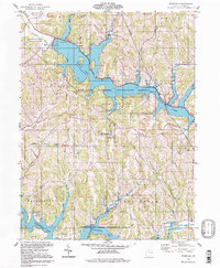
1994 Map of Deersville
USGS Topo · Published 1998About this map
Deersville serves as the central hub of this eastern Ohio landscape, situated on the high ground between two major reservoir systems. The area is defined by the Muskingum Watershed Conservancy District, which manages the irregular shorelines of Tappan Lake to the north and Clendening Lake to the south. These artificial water bodies, with designated pool elevations, flooded former stream valleys like Stillwater Creek and Brushy Fork, leaving behind a network of narrow, winding inlets.
Find a feature on this map
38 named features on this map. Tap any name to fly to it.
Don’t see what you’re looking for? This feature index may not catch every label — zoom into the map to look around manually.
Map Details
Editions of this 1994 Deersville Map
This is the sole edition of this map. No revisions or reprints were ever made.
Other maps of this area

1902 · Scio
USGS Topo · 1:62,500

1903 · Flushing
USGS Topo · 1:62,500

1904 · Scio
USGS Topo · 1:62,500

1905 · Flushing
USGS Topo · 1:62,500

1909 · Antrim
USGS Topo · 1:48,000

1909 · Uhrichsville
USGS Topo · 1:62,500

1911 · Antrim
USGS Topo · 1:62,500

1911 · Uhrichsville
USGS Topo · 1:62,500

1951 · Canton
USGS Topo · 1:250,000

1953 · Canton
USGS Topo · 1:250,000