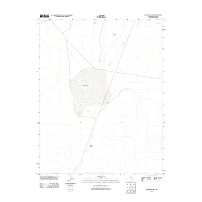
2012 Map of Delamar Lake
USGS Topo · Published 2012About this map
Delamar Lake dominates this arid landscape within the broader Delamar Valley, appearing here as a dry lake bed or playa characteristic of the Great Basin. This 2012 survey illustrates a desert environment where water management is critical, evidenced by a network of small reservoirs and catchment features ringing the dry lake. Notable water storage sites include Crack Reservoir to the north, Black Point Reservoir, and a series of perimeter basins such as Southside Reservoir and the Southeast Reservoirs. Drainage across the northern expanse is defined by the braided channels of Jumbo Wash, which cuts through the Delamar Flat before terminating near the lake margins. The map provides a clear look at the sparse infrastructure of this Lincoln County region, consisting primarily of unpaved tracks and 4WD trails that connect these isolated water points.
Find a feature on this map
10 named features on this map. Tap any name to fly to it.
Don’t see what you’re looking for? This feature index may not catch every label — zoom into the map to look around manually.
Map Details
Editions of this 2012 Delamar Lake Map
This is the sole edition of this map. No revisions or reprints were ever made.
Other maps of this area

1885 · Pioche
USGS Topo · 1:250,000

1886 · Pioche
USGS Topo · 1:250,000

1945 · Alamo
USGS Topo · 1:125,000

1954 · Caliente
USGS Topo · 1:250,000

1959 · Caliente
USGS Topo · 1:250,000

1969 · Alamo SE
USGS Topo · 1:24,000

1969 · Delamar
USGS Topo · 1:24,000

1969 · Gregerson Basin
USGS Topo · 1:24,000

1969 · Delamar 3 NE
USGS Topo · 1:24,000

1969 · Lower Pahranagat Lake
USGS Topo · 1:24,000