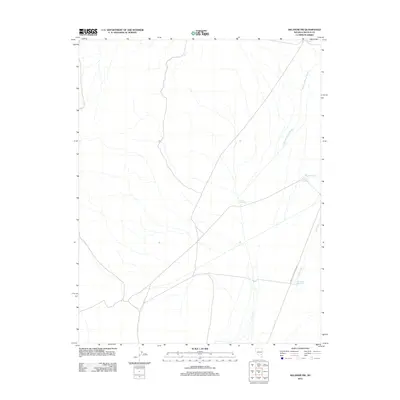
2012 Map of Delamar NW
USGS Topo · Published 2012About this map
Monkey Wrench Wash and Delamar Wash carve through this arid landscape in Lincoln County, Nevada, defining the drainage patterns of the high desert. The presence of Cyanide Reservoir and Chalk Reservoir suggests a history of water management tied to the region's land use, perhaps for livestock or earlier mining efforts. Human infrastructure is limited to specialized access, most notably the Power Line Maintenance Rd which transects the southern portion of the quadrangle. Other features like Powerline Reservoir and Cedar Wash highlight how local geography is organized around these essential watercourses and the utility corridors that cross the desert floor.
Find a feature on this map
7 named features on this map. Tap any name to fly to it.
Don’t see what you’re looking for? This feature index may not catch every label — zoom into the map to look around manually.
Map Details
Editions of this 2012 Delamar NW Map
This is the sole edition of this map. No revisions or reprints were ever made.
Other maps of this area

1885 · Pioche
USGS Topo · 1:250,000

1886 · Pioche
USGS Topo · 1:250,000

1945 · Alamo
USGS Topo · 1:125,000

1954 · Caliente
USGS Topo · 1:250,000

1959 · Caliente
USGS Topo · 1:250,000

1969 · Alamo SE
USGS Topo · 1:24,000

1969 · Delamar
USGS Topo · 1:24,000

1969 · Gregerson Basin
USGS Topo · 1:24,000

1969 · Alamo NE
USGS Topo · 1:24,000

1969 · Delamar NW
USGS Topo · 1:24,000