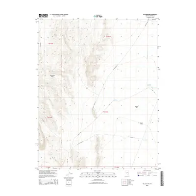
2014 Map of Delamar NW
USGS Topo · Published 2014About this map
The Pahroc Range and South Pahroc Range dominate the western horizon of this high-desert landscape in Lincoln County. To the east, the terrain levels out into the expansive Delamar Flat and Delamar Valley, where a network of remote ranching and industrial roads such as Mackie Reservoir Rd and Cyanide Rd crisscross the basin. The names of the water features—Cyanide Reservoir, Chalk Reservoir, and Monkey Wrench Wash—hint at the complex history of resource extraction and water management in this arid environment. This 2014 survey documents a modern snapshot of the basin's hydrology, including the Powerline Reservoir and Coyote Reservoir, which serve as vital collection points in an area defined by seasonal drainages like Delamar Wash and Cedar Wash.
Find a feature on this map
21 named features on this map. Tap any name to fly to it.
Don’t see what you’re looking for? This feature index may not catch every label — zoom into the map to look around manually.
Map Details
Editions of this 2014 Delamar NW Map
This is the sole edition of this map. No revisions or reprints were ever made.
Other maps of this area

1885 · Pioche
USGS Topo · 1:250,000

1886 · Pioche
USGS Topo · 1:250,000

1945 · Alamo
USGS Topo · 1:125,000

1954 · Caliente
USGS Topo · 1:250,000

1959 · Caliente
USGS Topo · 1:250,000

1969 · Alamo SE
USGS Topo · 1:24,000

1969 · Delamar
USGS Topo · 1:24,000

1969 · Gregerson Basin
USGS Topo · 1:24,000

1969 · Alamo NE
USGS Topo · 1:24,000

1969 · Delamar NW
USGS Topo · 1:24,000