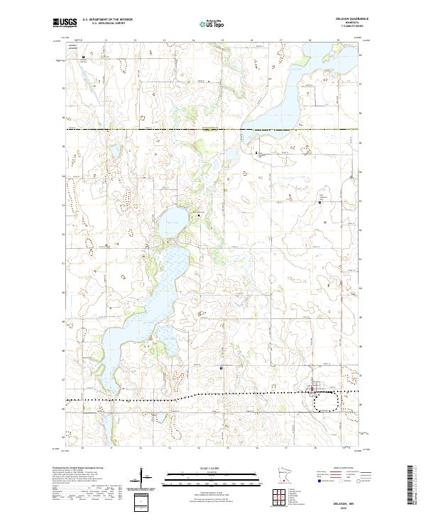
2022 Map of Delavan
USGS Topo · Published 2022About this map
Delavan sits at the southern edge of this Minnesota landscape, where the agricultural grid meets an intricate system of prairie lakes and drainage networks. The region is defined by its transition from open water to cultivated land, visible in the proximity of Rice Lake and Bass Lake to the broad Jackson Lakebed. This survey provides a precise look at the rural infrastructure of Faribault and Blue Earth counties, noting the path of Judicial Ditch Number Forty-nine as it manages the local hydrology. Genealogists will find significant value in the distribution of several rural burial grounds, including the West Lutheran Cem, East Lutheran Cem, and the Rice Lake Cem, which speak to the area's early Lutheran settlement patterns and local family histories near Rice Cr.
Find a feature on this map
60 named features on this map. Tap any name to fly to it.
Don’t see what you’re looking for? This feature index may not catch every label — zoom into the map to look around manually.
Map Details
Editions of this 2022 Delavan Map
This is the sole edition of this map. No revisions or reprints were ever made.
Other maps of this area

1954 · Fairmont
USGS Topo · 1:250,000

1954 · Mason City
USGS Topo · 1:250,000

1955 · Bricelyn
USGS Topo · 1:62,500

1957 · Mason City
USGS Topo · 1:250,000

1958 · Mason City
USGS Topo · 1:250,000

1958 · Fairmont
USGS Topo · 1:250,000

1967 · Winnebago
USGS Topo · 1:24,000

1967 · Huntley
USGS Topo · 1:24,000
1967 · Amboy
USGS Topo · 1:24,000
1967 · Mapleton
USGS Topo · 1:24,000