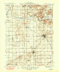
1942 Map of Delavan
USGS Topo · Published 1949About this map
Delavan and South Pekin anchor this mid-century portrait of Central Illinois, where a complex network of railroads and rural infrastructure defines the landscape. The Chicago and Northwestern and Alton lines intersect at San Jose, reflecting a period when rail remained central to the transport of agricultural goods. The terrain is marked by a high density of country schools and churches, such as Tullamore Sch and Sand Prairie Ch, which reveal the distributed nature of the rural population before mid-century consolidation. Drainage projects like the Main Ditch and Ditch alongside Crane Creek demonstrate the intensive effort to manage the fertile lowlands of Sand Prairie and Allen Grove. Notable family-named landmarks like Hickory Grove Sch and Meixsell Sch provide specific touchpoints for local genealogists tracing the legacy of these farming townships.
Find a feature on this map
73 named features on this map. Tap any name to fly to it.
Don’t see what you’re looking for? This feature index may not catch every label — zoom into the map to look around manually.
Map Details
Editions of this 1942 Delavan Map
3 editions found

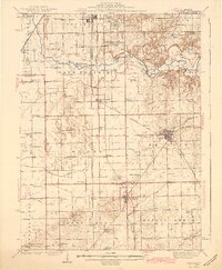
Other maps of this area

1905 · Peoria
USGS Topo · 1:62,500

1911 · Lincoln
USGS Topo · 1:62,500

1913 · Lincoln
USGS Topo · 1:62,500

1927 · Peoria
USGS Topo · 1:62,500

1928 · Mackinaw
USGS Topo · 1:62,500

1929 · Manito
USGS Topo · 1:62,500

1930 · Glasford
USGS Topo · 1:62,500

1932 · Mackinaw
USGS Topo · 1:62,500

1932 · Manito
USGS Topo · 1:62,500

1933 · Petersburg
USGS Topo · 1:62,500