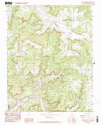
1985 Map of Delgadita Mesa
USGS Topo · Published 1985About this map
Manzanares Peak rises as a prominent landmark in this high-desert landscape, anchoring a complex geography of elevated plateaus and deeply cut drainages. The 1985 survey captures a network of mesa-top terrain including Manzanares Mesa, Romine Mesa, and Frances Mesa, separated by significant seasonal watercourses like Gobernador Canyon and Pueblo Delgadita Canyon. The border between San Juan and Rio Arriba counties bisects the western portion of the map, illustrating the jurisdictional divide in this part of New Mexico.
Find a feature on this map
22 named features on this map. Tap any name to fly to it.
Don’t see what you’re looking for? This feature index may not catch every label — zoom into the map to look around manually.
Map Details
Editions of this 1985 Delgadita Mesa Map
2 editions found
Other maps of this area

1889 · Largo
USGS Topo · 1:250,000

1895 · Largo
USGS Topo · 1:250,000

1954 · Pine River
USGS Topo · 1:24,000

1954 · Gomez Ranch
USGS Topo · 1:24,000

1954 · Aztec
USGS Topo · 1:250,000

1958 · Aztec
USGS Topo · 1:250,000

1959 · Gould Pass
USGS Topo · 1:62,500

1959 · Navajo Dam
USGS Topo · 1:62,500

1962 · Aztec
USGS Topo · 1:250,000

1963 · Fourmile Canyon
USGS Topo · 1:24,000