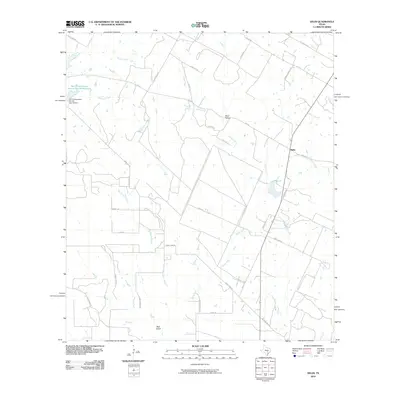
2010 Map of Delhi
USGS Topo · Published 2010About this map
Delhi and its surrounding ranch lands are defined by a network of seasonal watercourses and conservation infrastructure in the early 21st century. The landscape is dominated by the Sandy Fork and its tributaries, including Big Sandy Branch and Buck Branch, which drain through a series of natural features like Devil Hollow and Bear Gulch. A significant man-made feature, the Soil Conservation Service Site 29 Reservoir and its associated Soil Conservation Service Site 29 Dam, highlights the 20th-century efforts to manage water resources in this part of Caldwell County.
Find a feature on this map
38 named features on this map. Tap any name to fly to it.
Don’t see what you’re looking for? This feature index may not catch every label — zoom into the map to look around manually.
Map Details
Editions of this 2010 Delhi Map
This is the sole edition of this map. No revisions or reprints were ever made.
Other maps of this area

1901 · Flatonia
USGS Topo · 1:125,000

1911 · San Marcos
USGS Topo · 1:125,000

1919 · San Marcos
USGS Topo · 1:125,000

1925 · San Marcos 1-d
USGS Topo · 1:48,000

1925 · San Marcos 4-a
USGS Topo · 1:48,000

1929 · Luling
USGS Topo · 1:62,500

1930 · Lockhart
USGS Topo · 1:62,500

1953 · Seguin
USGS Topo · 1:250,000

1958 · Seguin
USGS Topo · 1:250,000
1963 · McMahan
USGS Topo · 1:24,000