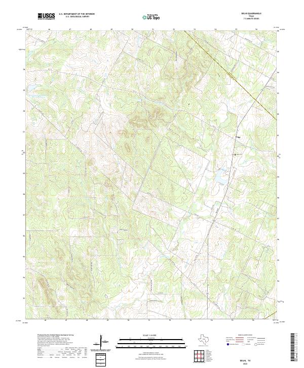
2022 Map of Delhi
USGS Topo · Published 2022About this map
The unincorporated community of Delhi sits at the intersection of FM 713 and State Highway 304, marking a point of quiet settlement along the Bastrop Co Caldwell Co line. This rural landscape is defined by the complex drainage systems of the Sandy Fork and its tributaries, including Big Sandy Br and Tenney Cr. These waterways cut through the terrain to create distinctive local landmarks like Devil Hollow, Bear Gulch, and Chalk Hollow, reflecting a topography of eroding draws and seasonal creeks characteristic of this part of Central Texas.
Find a feature on this map
49 named features on this map. Tap any name to fly to it.
Don’t see what you’re looking for? This feature index may not catch every label — zoom into the map to look around manually.
Map Details
Editions of this 2022 Delhi Map
This is the sole edition of this map. No revisions or reprints were ever made.
Other maps of this area

1901 · Flatonia
USGS Topo · 1:125,000

1911 · San Marcos
USGS Topo · 1:125,000

1919 · San Marcos
USGS Topo · 1:125,000

1925 · San Marcos 1-d
USGS Topo · 1:48,000

1925 · San Marcos 4-a
USGS Topo · 1:48,000

1929 · Luling
USGS Topo · 1:62,500

1930 · Lockhart
USGS Topo · 1:62,500

1953 · Seguin
USGS Topo · 1:250,000

1958 · Seguin
USGS Topo · 1:250,000
1963 · McMahan
USGS Topo · 1:24,000