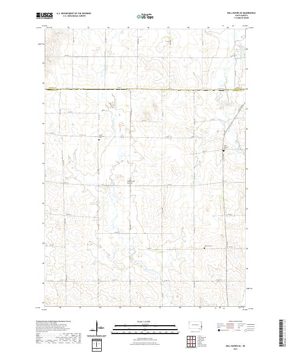
2021 Map of Dell Rapids SE
USGS Topo · Published 2021About this map
The eastern edge of the Coteau des Prairies upland dominates this portion of the South Dakota landscape, where the rolling heights begin their gradual descent toward the Minnesota border. The topography is defined by the winding course of W Pipestone Cr and Pipestone Cr, which cut through the glacial plateau. The map reveals a deeply established rural community structured by a rigorous section-line road grid, including Co HWY 104 and Co HWY 109. Genealogists will find significant value in the distribution of local burial grounds, such as the Logan Reformed Cem in the northwest and both the North Highland Cem and Highland Cem further south. These landmarks, along with the settlement at Logan St, provide a clear picture of the historical agricultural and social centers that have anchored Minnehaha Co for generations.
Find a feature on this map
32 named features on this map. Tap any name to fly to it.
Don’t see what you’re looking for? This feature index may not catch every label — zoom into the map to look around manually.
Map Details
Editions of this 2021 Dell Rapids SE Map
This is the sole edition of this map. No revisions or reprints were ever made.
Other maps of this area

1955 · Sioux Falls
USGS Topo · 1:250,000

1958 · Sioux Falls
USGS Topo · 1:250,000

1962 · Dell Rapids
USGS Topo · 1:24,000

1962 · Renner
USGS Topo · 1:24,000

1962 · Garretson West
USGS Topo · 1:24,000

1963 · Trent
USGS Topo · 1:24,000

1967 · Garretson East
USGS Topo · 1:24,000

1967 · Jasper
USGS Topo · 1:24,000

1967 · Jasper NW
USGS Topo · 1:24,000
1972 · Dell Rapids NE
USGS Topo · 1:24,000
Featured Places
- Blinsmon Township, SD
- Highland Township, SD
- Alliance Township, SD
- Edison Township, SD
- Logan Township, SD