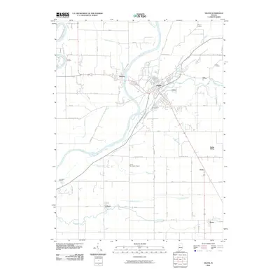
2010 Map of Delphi
USGS Topo · Published 2010About this map
The Wabash River and the Tippecanoe River meet in this portion of Carroll County, defining a landscape shaped by water and transport. The city of Delphi sits at the heart of the map, surrounded by numerous graveyards that serve as vital touchstones for family historians, including Saint Josephs Cemetery, Delphi Cemetery, and Robinson Cemetery. Across the water, the settlement of Pittsburg occupies the western bank, while further south, the rural communities of Colburn and Radnor anchor the agricultural grid.
Find a feature on this map
51 named features on this map. Tap any name to fly to it.
Don’t see what you’re looking for? This feature index may not catch every label — zoom into the map to look around manually.
Map Details
Editions of this 2010 Delphi Map
This is the sole edition of this map. No revisions or reprints were ever made.
Other maps of this area

1953 · Danville
USGS Topo · 1:250,000

1955 · Danville
USGS Topo · 1:250,000

1956 · Danville
USGS Topo · 1:250,000

1961 · Pyrmont
USGS Topo · 1:24,000

1961 · Lafayette East
USGS Topo · 1:24,000

1961 · Rossville
USGS Topo · 1:24,000

1962 · Flora
USGS Topo · 1:24,000

1962 · Burrows
USGS Topo · 1:24,000

1962 · Monticello South
USGS Topo · 1:24,000

1962 · Delphi
USGS Topo · 1:24,000