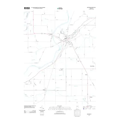
2013 Map of Delphi
USGS Topo · Published 2013About this map
Delphi serves as the central hub of this Indiana landscape, situated at the confluence of several vital waterways and historic transit routes. The enduring imprint of the Wabash and Erie Canal follows the curve of the Wabash River, illustrating the town's early 19th-century reliance on water-based commerce. The surrounding terrain is a network of agricultural lands and smaller settlements like Pittsburg to the northwest and Colburn to the southwest.
Find a feature on this map
119 named features on this map. Tap any name to fly to it.
Don’t see what you’re looking for? This feature index may not catch every label — zoom into the map to look around manually.
Map Details
Editions of this 2013 Delphi Map
This is the sole edition of this map. No revisions or reprints were ever made.
Other maps of this area

1953 · Danville
USGS Topo · 1:250,000

1955 · Danville
USGS Topo · 1:250,000

1956 · Danville
USGS Topo · 1:250,000

1961 · Pyrmont
USGS Topo · 1:24,000

1961 · Lafayette East
USGS Topo · 1:24,000

1961 · Rossville
USGS Topo · 1:24,000

1962 · Flora
USGS Topo · 1:24,000

1962 · Burrows
USGS Topo · 1:24,000

1962 · Monticello South
USGS Topo · 1:24,000

1962 · Delphi
USGS Topo · 1:24,000