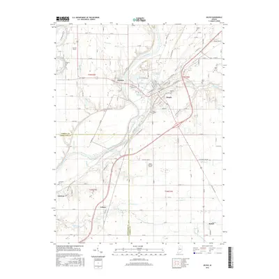
2016 Map of Delphi
USGS Topo · Published 2016About this map
Wabash River waters dominate this landscape, where the historic path of the Wabash and Erie Canal traces the valley floor near Delphi. This mid-2010s survey captures the area's established geography, from the settlement of Pittsburg on the western bank to the small communities of Colburn, Americus, and Radnor further south. The map provides a detailed view of local burial sites, including the Saint Josephs Cem and Cunningham Cem, which are vital for genealogical research in this part of Carroll and Tippecanoe Counties. The convergence of Deer Creek and Robinson Br with the main river channel illustrates the drainage patterns that have shaped local industry and town placement. While the Delphi Municipal Airport represents modern infrastructure, the underlying grid of rural roads and water bodies like Sugar Creek maintains the traditional agricultural character of the Indiana countryside.
Find a feature on this map
119 named features on this map. Tap any name to fly to it.
Don’t see what you’re looking for? This feature index may not catch every label — zoom into the map to look around manually.
Map Details
Editions of this 2016 Delphi Map
This is the sole edition of this map. No revisions or reprints were ever made.
Other maps of this area

1953 · Danville
USGS Topo · 1:250,000

1955 · Danville
USGS Topo · 1:250,000

1956 · Danville
USGS Topo · 1:250,000

1961 · Pyrmont
USGS Topo · 1:24,000

1961 · Lafayette East
USGS Topo · 1:24,000

1961 · Rossville
USGS Topo · 1:24,000

1962 · Flora
USGS Topo · 1:24,000

1962 · Burrows
USGS Topo · 1:24,000

1962 · Monticello South
USGS Topo · 1:24,000

1962 · Delphi
USGS Topo · 1:24,000