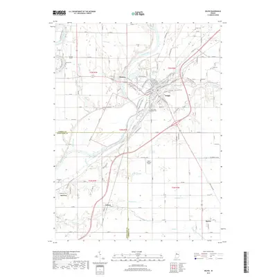
2019 Map of Delphi
USGS Topo · Published 2019About this map
Delphi serves as the focal point of this Indiana landscape, situated at the confluence of the Wabash River and Deer Creek. The map provides a detailed view of the town's historical infrastructure, most notably the path of the Wabash and Erie Canal as it parallels the river through the heart of the community. This waterway once served as a vital commercial artery, and its presence here alongside the modern street grid and the Delphi Municipal Airport illustrates the evolution of regional transportation from 19th-century towpaths to 21st-century aviation.
Find a feature on this map
87 named features on this map. Tap any name to fly to it.
Don’t see what you’re looking for? This feature index may not catch every label — zoom into the map to look around manually.
Map Details
Editions of this 2019 Delphi Map
This is the sole edition of this map. No revisions or reprints were ever made.
Other maps of this area

1953 · Danville
USGS Topo · 1:250,000

1955 · Danville
USGS Topo · 1:250,000

1956 · Danville
USGS Topo · 1:250,000

1961 · Pyrmont
USGS Topo · 1:24,000

1961 · Lafayette East
USGS Topo · 1:24,000

1961 · Rossville
USGS Topo · 1:24,000

1962 · Flora
USGS Topo · 1:24,000

1962 · Burrows
USGS Topo · 1:24,000

1962 · Monticello South
USGS Topo · 1:24,000

1962 · Delphi
USGS Topo · 1:24,000