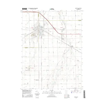
2016 Map of Delphos
USGS Topo · Published 2016About this map
Delphos serves as a central hub where the borders of Van Wert, Putnam, and Allen counties converge. This 2016 survey shows a landscape defined by an orderly grid of roads and the winding path of the Auglaize River, which snakes through the eastern half of the quadrangle. The town's layout reflects its historic growth along the canal and rail corridors, with a dense network of streets like S Main St and Spencerville Ave radiating from the center.
Find a feature on this map
129 named features on this map. Tap any name to fly to it.
Don’t see what you’re looking for? This feature index may not catch every label — zoom into the map to look around manually.
Map Details
Editions of this 2016 Delphos Map
This is the sole edition of this map. No revisions or reprints were ever made.
Other maps of this area

1906 · Lima
USGS Topo · 1:62,500

1906 · Columbus Grove
USGS Topo · 1:62,500

1908 · Columbus Grove
USGS Topo · 1:62,500

1911 · Spencerville
USGS Topo · 1:62,500

1911 · Delphos
USGS Topo · 1:62,500

1944 · Delphos
USGS Topo · 1:62,500

1944 · Spencerville
USGS Topo · 1:62,500

1953 · Muncie
USGS Topo · 1:250,000

1956 · Muncie
USGS Topo · 1:250,000
1960 · Ottoville
USGS Topo · 1:24,000