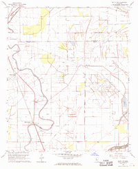
1968 Map of Delta City
USGS Topo · Published 1970About this map
Deer Creek meanders through the alluvial landscape of the Mississippi Delta on this 1960s survey, marking a corridor of settlement and transport. Along its banks, the Illinois Central railroad connects local hubs like Nitta Yuma and Panther Burn, while numerous Indian Mounds and Indian Mound markers testify to a deep history of human occupation preceding the modern agricultural grid. The map reveal a dense network of rural community landmarks, including the Delta City Cem, Pleasant Valley Ch, and Eastern Star Ch.
Find a feature on this map
38 named features on this map. Tap any name to fly to it.
Don’t see what you’re looking for? This feature index may not catch every label — zoom into the map to look around manually.
Map Details
Editions of this 1968 Delta City Map
2 editions found
Other maps of this area

1939 · Lorenzen
USGS Topo · 1:62,500

1939 · Swan Lake
USGS Topo · 1:62,500

1940 · Auter
USGS Topo · 1:62,500

1953 · Greenwood
USGS Topo · 1:250,000

1955 · Jackson
USGS Topo · 1:250,000

1956 · Greenwood
USGS Topo · 1:250,000

1961 · Jackson
USGS Topo · 1:250,000

1961 · Bayland
USGS Topo · 1:62,500

1962 · Jackson
USGS Topo · 1:250,000

1964 · Lorenzen
USGS Topo · 1:62,500