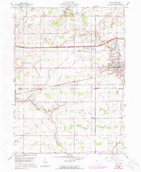
1960 Map of Delta
USGS Topo · Published 1990About this map
Delta serves as the central hub of this Northwest Ohio landscape, surrounded by a dense network of family-named cemeteries and rural institutions that speak to the deep-rooted genealogical history of Fulton Line. The map reveals a transition in transportation technology, where the high-speed Ohio Toll Road Turnpike cuts across the northern townships, contrasting with the established paths of the Penn Central, Detroit Toledo and Ironton, and Norfolk and Western railroads. Away from the main rail corridors, the land is dotted with local landmarks like Grieser Airport, Grange Hall, and several country schools including Township Sch. Water features such as Bad Creek and the Delta Reservoir define the local topography, while small settlements like Winameg and West Delta maintain their individual character within the larger townships of York, Pike, and Clinton.
Find a feature on this map
37 named features on this map. Tap any name to fly to it.
Don’t see what you’re looking for? This feature index may not catch every label — zoom into the map to look around manually.
Map Details
Editions of this 1960 Delta Map
3 editions found
Other maps of this area

1908 · Napoleon
USGS Topo · 1:62,500

1909 · Mc Clure
USGS Topo · 1:62,500

1911 · Wauseon
USGS Topo · 1:62,500

1911 · Swanton
USGS Topo · 1:62,500

1913 · Wauseon
USGS Topo · 1:62,500

1914 · Swanton
USGS Topo · 1:62,500

1943 · Wauseon
USGS Topo · 1:62,500

1953 · Fort Wayne
USGS Topo · 1:250,000

1956 · Fort Wayne
USGS Topo · 1:250,000

1956 · Toledo
USGS Topo · 1:250,000