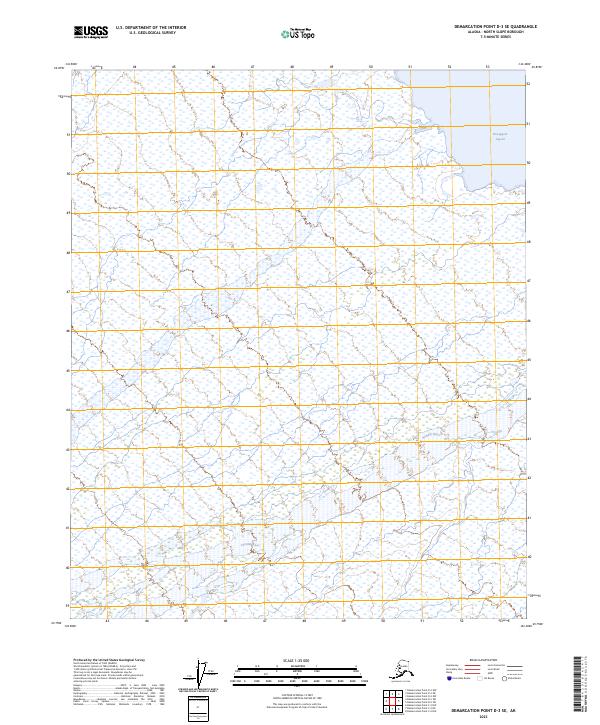
2023 Map of Demarcation Point D-3 SE
USGS Topo · Published 2023About this map
Mollie Beattie Wilderness and the Arctic National Wildlife Refuge dominate this coastal landscape on the edge of the Beaufort Sea. The map traces the winding course of the Aichilik River as it flows toward the northern coastline, cutting through a complex network of wetlands and tundra. Along the northeastern shore, the Nuvagapa Lagoon provides a distinct coastal boundary between the land and the Arctic waters. This modern survey reflects the preserved state of the North Slope, where the absence of roads and permanent settlements emphasizes the protected status of the wilderness areas. The terrain is defined by the hydrologic patterns of the river delta and the seasonal shifts of the arctic environment, providing a precise record of the shoreline and internal waterways in the early 21st century.
Find a feature on this map
8 named features on this map. Tap any name to fly to it.
Don’t see what you’re looking for? This feature index may not catch every label — zoom into the map to look around manually.
Map Details
Editions of this 2023 Demarcation Point D-3 SE Map
This is the sole edition of this map. No revisions or reprints were ever made.
Other maps of this area

1951 · Demarcation Point
USGS Topo · 1:250,000

1955 · Demarcation Point
USGS Topo · 1:250,000

1955 · Demarcation Point D-3
USGS Topo · 1:63,360

1955 · Demarcation Point D-2
USGS Topo · 1:63,360

1955 · Demarcation Point C-2
USGS Topo · 1:63,360

1955 · Demarcation Point C-3
USGS Topo · 1:63,360

1962 · Demarcation Point D-3
USGS Topo · 1:50,000

1964 · Demarcation Point
USGS Topo · 1:250,000
2018 · Demarcation Point C-2 NW
USGS Topo · 1:25,000
2018 · Demarcation Point D-2 SW
USGS Topo · 1:25,000