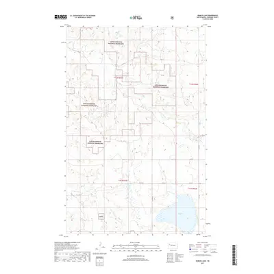
2017 Map of Demicks Lake
USGS Topo · Published 2017About this map
The Little Missouri National Grassland dominates this portion of McKenzie County, where the high plains landscape is defined by an intricate network of drainages and coulees. Water is the primary architect of the local geography, with Bartlett Cr and Clear Cr carving paths through the northern sections, while Greenley Coulee and Jackson Coulee mark the central terrain. In the southeast, Demicks Lake provides a significant hydrological marker near the junction of several section lines and local routes like 34th St.
Find a feature on this map
19 named features on this map. Tap any name to fly to it.
Don’t see what you’re looking for? This feature index may not catch every label — zoom into the map to look around manually.
Map Details
Editions of this 2017 Demicks Lake Map
This is the sole edition of this map. No revisions or reprints were ever made.
Other maps of this area

1911 · Ray
USGS Topo · 1:125,000

1953 · Williston
USGS Topo · 1:250,000

1953 · Watford City
USGS Topo · 1:250,000

1957 · Williston
USGS Topo · 1:250,000

1957 · Watford City
USGS Topo · 1:250,000

1965 · Keene
USGS Topo · 1:24,000

1965 · Johnsons Corner
USGS Topo · 1:24,000

1965 · Charlson SW
USGS Topo · 1:24,000

1967 · Watford City
USGS Topo · 1:250,000

1978 · Tobacco Garden Bay
USGS Topo · 1:24,000