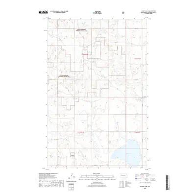
2020 Map of Demicks Lake
USGS Topo · Published 2020About this map
Little Missouri National Grassland dominates this section of McKenzie County, where the high plains are carved by a network of seasonal coulees and creeks. The landscape is defined by the drainage patterns of Clear Cr and its northern branch, alongside smaller features like Greeneu Coulee and Jackson Coulee. This 2020 survey illustrates a sparsely populated ranching and conservation area, primarily accessed via a grid of secondary routes like Co RD 10 and 37th St NW. To the south, Demicks Lake stands out as a significant water body in an otherwise semi-arid environment, fed by the waters of Timber Prong Cr. The map provides a clear look at the intersection of public land management and the geometric township and range system that organized the North Dakota frontier.
Find a feature on this map
22 named features on this map. Tap any name to fly to it.
Don’t see what you’re looking for? This feature index may not catch every label — zoom into the map to look around manually.
Map Details
Editions of this 2020 Demicks Lake Map
This is the sole edition of this map. No revisions or reprints were ever made.
Other maps of this area

1911 · Ray
USGS Topo · 1:125,000

1953 · Williston
USGS Topo · 1:250,000

1953 · Watford City
USGS Topo · 1:250,000

1957 · Williston
USGS Topo · 1:250,000

1957 · Watford City
USGS Topo · 1:250,000

1965 · Keene
USGS Topo · 1:24,000

1965 · Johnsons Corner
USGS Topo · 1:24,000

1965 · Charlson SW
USGS Topo · 1:24,000

1967 · Watford City
USGS Topo · 1:250,000

1978 · Tobacco Garden Bay
USGS Topo · 1:24,000