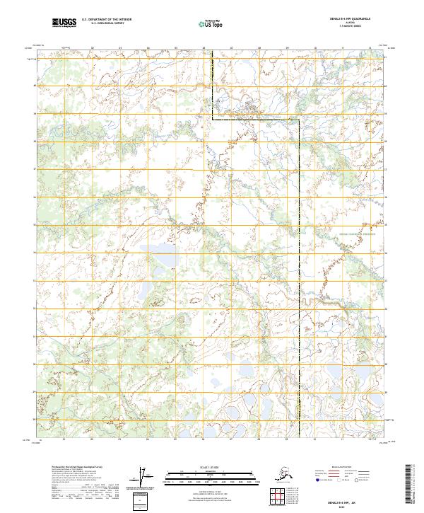
2023 Map of Denali B-6 NW
USGS Topo · Published 2023About this map
Denali National Preserve encompasses a significant portion of this interior Alaskan landscape, characterized by an intricate network of waterways and wetlands. The Shisnona River and its associated Shisnona-Lake serve as central hydrographic features, joined by Highpower Creek and Lonestar Creek as they traverse the subarctic terrain. The boundary between the Yukon-Koyukuk Census Area and Denali Borough bisects the northern section of the map, marking a formal administrative divide in an otherwise undeveloped wilderness. This recent survey by the U.S. Geological Survey details the natural drainage patterns of the Fish River and Deep Creek, providing a contemporary record of this protected ecosystem where few man-made structures or roads are present.
Find a feature on this map
14 named features on this map. Tap any name to fly to it.
Don’t see what you’re looking for? This feature index may not catch every label — zoom into the map to look around manually.
Map Details
Editions of this 2023 Denali B-6 NW Map
This is the sole edition of this map. No revisions or reprints were ever made.
Other maps of this area

1950 · Medfra
USGS Topo · 1:250,000

1952 · Mount McKinley
USGS Topo · 1:250,000

1958 · Medfra C-1
USGS Topo · 1:63,360

1958 · Mount McKinley B-6
USGS Topo · 1:63,360

1958 · Mount McKinley C-6
USGS Topo · 1:63,360

1958 · Mount McKinley
USGS Topo · 1:250,000

1958 · Medfra B-1
USGS Topo · 1:63,360

1959 · Medfra
USGS Topo · 1:250,000

1969 · Mount McKinley
USGS Topo · 1:250,000
2017 · Denali B-6 SW
USGS Topo · 1:25,000