
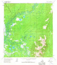
1958 Map of Medfra C-1
USGS Topo · Published 1964About this map
The North Fork Kuskokwim River and Swift Fork Kuskokwim River dominate this interior Alaskan landscape, showing a complex network of meandering channels and seasonal wetlands. Recorded in the late 1950s, the terrain is defined by the sharp transition between the river lowlands and the rising peaks of the Munsatli Mountains and Telida Mountains. A single Cabin in the northwest corner and a documented Winter Trail represent the sparse human footprint in this wilderness during the mid-century era.
Find a feature on this map
18 named features on this map. Tap any name to fly to it.
Don’t see what you’re looking for? This feature index may not catch every label — zoom into the map to look around manually.
Map Details
Editions of this 1958 Medfra C-1 Map
2 editions found
Other maps of this area

1950 · Medfra
USGS Topo · 1:250,000

1952 · Mount McKinley
USGS Topo · 1:250,000

1958 · Medfra D-2
USGS Topo · 1:63,360

1958 · Medfra C-2
USGS Topo · 1:63,360

1958 · Medfra B-2
USGS Topo · 1:63,360

1958 · Medfra D-1
USGS Topo · 1:63,360

1958 · Mount McKinley B-6
USGS Topo · 1:63,360

1958 · Mount McKinley D-6
USGS Topo · 1:63,360

1958 · Mount McKinley C-6
USGS Topo · 1:63,360

1958 · Mount McKinley
USGS Topo · 1:250,000