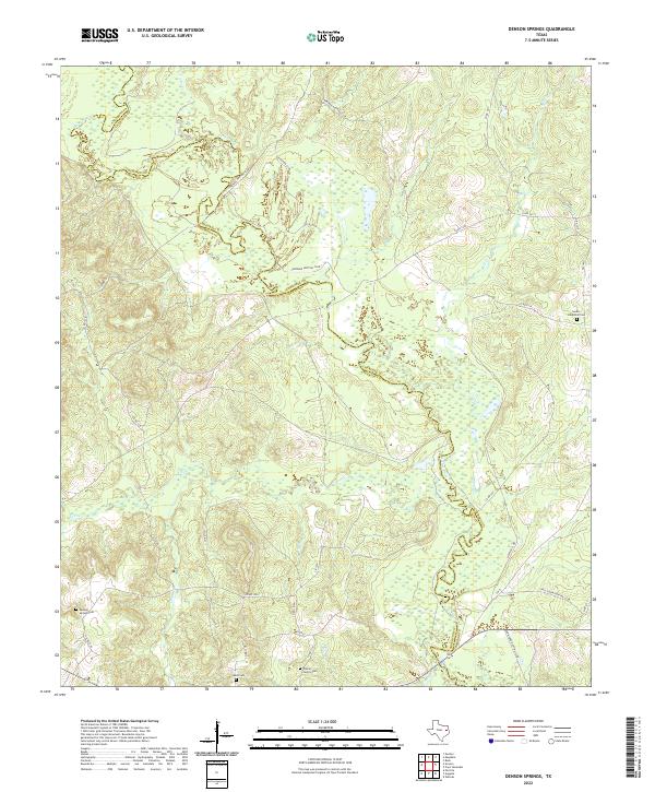
2022 Map of Denson Springs
USGS Topo · Published 2022About this map
The Neches River forms the winding eastern boundary of Anderson County on this recent survey, dividing it from Cherokee County through a heavily forested bottomland. The landscape is defined by its numerous hunting camps and riparian corridors, including the Cherokee Hunting Club and Bull Creek Hunting Club, which suggest a modern economy rooted in conservation and recreation rather than intensive agriculture. Genealogists and local historians will find several burial sites preserved across these woods, from the larger Denson Springs Cem to more secluded locations such as the Wilson Family Cem. The complex network of creeks, such as Joni Cr and Bird Br, illustrates the natural drainage patterns that have shaped land use in this part of East Texas for generations, while a web of county roads like Co RD 1222 connects these remote settlements and tracts.
Find a feature on this map
32 named features on this map. Tap any name to fly to it.
Don’t see what you’re looking for? This feature index may not catch every label — zoom into the map to look around manually.
Map Details
Editions of this 2022 Denson Springs Map
This is the sole edition of this map. No revisions or reprints were ever made.
Other maps of this area

1943 · Rusk
USGS Topo · 1:62,500

1945 · Rusk
USGS Topo · 1:62,500

1946 · Alto
USGS Topo · 1:62,500

1951 · Jacksonville
USGS Topo · 1:62,500

1952 · Slocum
USGS Topo · 1:62,500

1953 · Palestine
USGS Topo · 1:250,000

1957 · Palestine
USGS Topo · 1:250,000
1973 · Pryor Mountain
USGS Topo · 1:24,000
1973 · Weches
USGS Topo · 1:24,000
1973 · Rusk
USGS Topo · 1:24,000