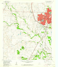
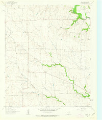
1960 Map of Denton West
USGS Topo · Published 1962About this map
The western edge of Denton is defined by a landscape transitioning from a collegiate urban center to the livestock and agricultural lands of North Texas. The city's mid-century expansion is anchored by North Texas State College and Texas Womans University, while the downtown core shows essential civic landmarks like City Hall, the Courthouse, and Flow Hospital. Significant transport corridors include the Gulf Colorado and Santa Fe and the Texas and Pacific railroads, which move through a terrain dotted with distinct elevations like Pilot Knob and Bald Knob. To the west, the Denton Airport and the Texas A & M College Exper Sta No 6 highlight the region's focus on aviation and agricultural research. The presence of the Garza-Little Elm Reservoir in the southeast indicates the importance of water management in the watershed of Hickory Creek and its various branches.
Find a feature on this map
46 named features on this map. Tap any name to fly to it.
Don’t see what you’re looking for? This feature index may not catch every label — zoom into the map to look around manually.
Map Details
Editions of this 1960 Denton West Map
4 editions found
Other maps of this area

1954 · Sherman
USGS Topo · 1:250,000

1958 · Sherman
USGS Topo · 1:250,000

1959 · Ponder
USGS Topo · 1:24,000
1960 · Justin
USGS Topo · 1:24,000

1960 · Sanger
USGS Topo · 1:24,000

1960 · Green Valley
USGS Topo · 1:24,000
1960 · Argyle
USGS Topo · 1:24,000
1960 · Lewisville West
USGS Topo · 1:24,000
1960 · Denton East
USGS Topo · 1:24,000
1961 · Era SE
USGS Topo · 1:24,000