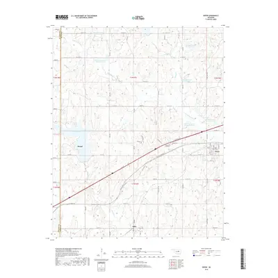
2018 Map of Depew
USGS Topo · Published 2018About this map
The town of Depew and the eastern edge of Stroud anchor this central Oklahoma landscape, where the legacy of early transcontinental travel remains visible through the alignment of Old State Highway 66 and Old Hwy 66. These historic corridors cut diagonally across the terrain, connecting the larger settlements with the community of Milfay to the south. The area is defined by an extensive water management system along Little Deep Fork Creek, featuring numerous reservoirs such as Little Deep Fork Cr Site 18 Reservoir and Site 20 Reservoir. Beyond the towns, the map details rural landmarks like the Memorial Club Cem and Oakdale Cem, alongside substantial water bodies including Stroud Lake and the Stroud Reservoir, providing a clear view of the region's mid-20th-century development and hydraulic infrastructure.
Find a feature on this map
54 named features on this map. Tap any name to fly to it.
Don’t see what you’re looking for? This feature index may not catch every label — zoom into the map to look around manually.
Map Details
Editions of this 2018 Depew Map
This is the sole edition of this map. No revisions or reprints were ever made.
Other maps of this area

1901 · Nuyaka
USGS Topo · 1:125,000

1916 · Bristow
USGS Topo · 1:62,500

1929 · Stroud
USGS Topo · 1:62,500

1931 · Drumright
USGS Topo · 1:62,500

1932 · Stroud
USGS Topo · 1:62,500

1954 · Oklahoma City
USGS Topo · 1:250,000

1957 · Oklahoma City
USGS Topo · 1:250,000

1963 · Oklahoma City
USGS Topo · 1:250,000
1971 · Bellvue
USGS Topo · 1:24,000
1973 · Gypsy
USGS Topo · 1:24,000