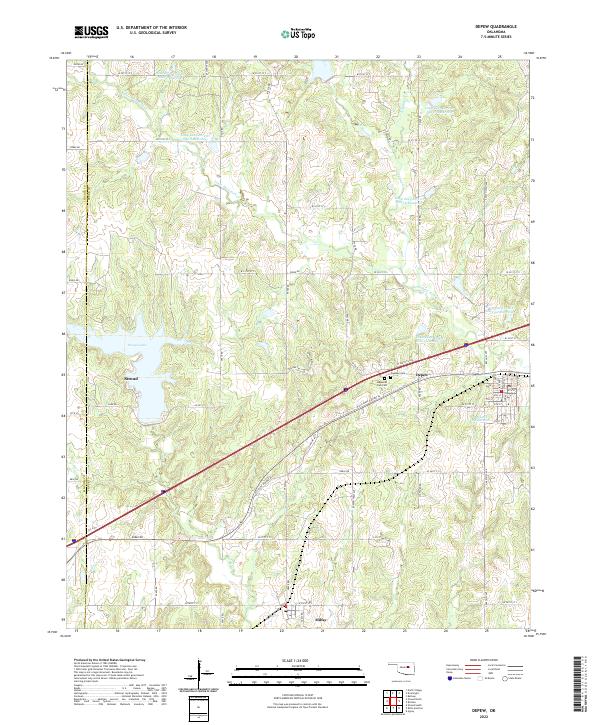
2022 Map of Depew
USGS Topo · Published 2022About this map
The town of Stroud and the nearby settlement of Depew anchor this corridor of central Oklahoma, where the landscape is defined by the legacy of early water management and transportation. A series of reservoirs, including Little Deep Fork Cr Site 7 Reservoir and Little Deep Fork Cr Site 55c Reservoir, dot the tributaries of Little Deep Fork Cr, reflecting a highly engineered rural watershed. This 2022 survey captures the modern road network, including W Old State Highway 66, which runs parallel to the primary east-west highway route.
Find a feature on this map
58 named features on this map. Tap any name to fly to it.
Don’t see what you’re looking for? This feature index may not catch every label — zoom into the map to look around manually.
Map Details
Editions of this 2022 Depew Map
This is the sole edition of this map. No revisions or reprints were ever made.
Other maps of this area

1901 · Nuyaka
USGS Topo · 1:125,000

1916 · Bristow
USGS Topo · 1:62,500

1929 · Stroud
USGS Topo · 1:62,500

1931 · Drumright
USGS Topo · 1:62,500

1932 · Stroud
USGS Topo · 1:62,500

1954 · Oklahoma City
USGS Topo · 1:250,000

1957 · Oklahoma City
USGS Topo · 1:250,000

1963 · Oklahoma City
USGS Topo · 1:250,000
1971 · Bellvue
USGS Topo · 1:24,000
1973 · Gypsy
USGS Topo · 1:24,000