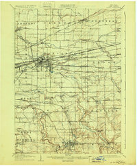
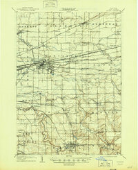
1905 Map of Depew
USGS Topo · Published 1930About this map
Depew and Lancaster emerge as significant industrial and rail hubs in this early twentieth-century landscape, dominated by a dense network of competing trunk lines. The New York Central and Hudson River RR, Lehigh Valley RR, and the Erie RR converge here, creating a complex grid of tracks and junctions that fueled the regional economy. Smaller communities like Bowmansville and Looneyville are documented alongside specialized railroad stops such as Marilla Sta and Town Line Sta, reflecting a time when the rails dictated the growth of Erie County.
Find a feature on this map
92 named features on this map. Tap any name to fly to it.
Don’t see what you’re looking for? This feature index may not catch every label — zoom into the map to look around manually.
Map Details
Editions of this 1905 Depew Map
6 editions found

Other maps of this area

1894 · Buffalo
USGS Topo · 1:62,500

1897 · Tonawanda
USGS Topo · 1:62,500

1897 · Medina
USGS Topo · 1:62,500

1897 · Lockport
USGS Topo · 1:62,500

1899 · Niagara
USGS Topo · 1:125,000

1900 · Tonawanda
USGS Topo · 1:62,500

1901 · Buffalo
USGS Topo · 1:62,500

1901 · Tonawanda
USGS Topo · 1:62,500

1902 · Lockport
USGS Topo · 1:62,500

1905 · Attica
USGS Topo · 1:62,500