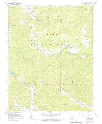
1968 Map of Des Arc NE
USGS Topo · Published 1969About this map
Clark National Forest dominates this landscape, where the rugged terrain of the St. Francois Mountains transitions across the Iron and Madison County line. The 1968 field-checked survey reveals a quiet rural landscape defined by narrow hollows like Reader Hollow and the winding course of Marble Creek. Isolated communities and crossroads such as Minimum and Jewett anchor the southeastern corner, while the interior is largely traversed by an intricate network of jeep trails and a prominent pipeline. For genealogists, the map is remarkably dense with family-named landmarks and small burial grounds, including the Shoemaker Cem, Kelley Cem, and Davis Cem. Institutional life is centered around local congregations at Liberty United Ch and Black Mountain Ch, situated near the base of Patterson Mountain.
Find a feature on this map
31 named features on this map. Tap any name to fly to it.
Don’t see what you’re looking for? This feature index may not catch every label — zoom into the map to look around manually.
Map Details
Editions of this 1968 Des Arc NE Map
2 editions found
Other maps of this area

1926 · Des Arc
USGS Topo · 1:62,500

1929 · Des Arc
USGS Topo · 1:62,500

1930 · Coldwater
USGS Topo · 1:62,500

1937 · Ironton
USGS Topo · 1:48,000

1939 · Fredericktown
USGS Topo · 1:48,000

1945 · Ironton
USGS Topo · 1:62,500

1946 · Ironton
USGS Topo · 1:62,500

1947 · Fredericktown
USGS Topo · 1:62,500

1949 · Rolla
USGS Topo · 1:250,000

1949 · Coldwater
USGS Topo · 1:62,500