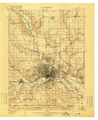
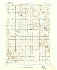
1907 Map of Des Moines
USGS Topo · Published 1919About this map
Des Moines serves as the focal point of this 1907 survey, revealing the city's complex rail infrastructure and early suburban layout before the major expansions of the mid-20th century. The confluence of the Des Moines River and Raccoon River anchors the central district, surrounded by distinct neighborhoods like Highland Park and Easton Place. Industrial and recreational hubs are clearly marked, including the sprawling State Fairgrounds and the Chautauqua Grounds along the riverbanks.
Find a feature on this map
78 named features on this map. Tap any name to fly to it.
Don’t see what you’re looking for? This feature index may not catch every label — zoom into the map to look around manually.
Map Details
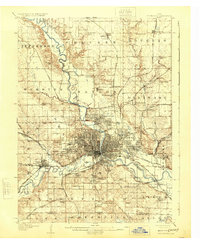
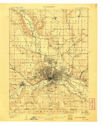
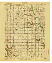
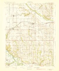
Editions of this 1907 Des Moines Map
3 editions found
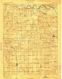
Other maps of this area

1905 · Des Moines
USGS Topo · 1:62,500
1907 · Des Moines
USGS Topo · 1:62,500

1908 · Waukee
USGS Topo · 1:62,500
1910 · Milo
USGS Topo · 1:62,500

1911 · Madrid
USGS Topo · 1:62,500
1911 · Slater
USGS Topo · 1:62,500
1913 · Slater
USGS Topo · 1:62,500

1914 · Madrid
USGS Topo · 1:62,500
1930 · Mitchellville
USGS Topo · 1:62,500

1931 · Indianola
USGS Topo · 1:62,500