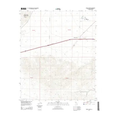
2015 Map of Desert Center
USGS Topo · Published 2015About this map
Desert Center serves as the primary outpost in this arid landscape, situated at a vital desert crossroads where Ragsdale Rd and Rice Rd converge. The settlement of Lake Tamaris k appears to the northeast, providing a rare residential cluster in the Chuckwalla Valley. To the northwest, the map captures a portion of Joshua Tree National Park, where the high elevations of the Eagle Mountains contrast sharply with the alluvial fans below. The southern half of the quadrangle is defined by a dense network of desert drainage systems, including Corn Springs Wash and Red Cloud Wash, which cut through the complex topography south of the interstate corridor. Notable landmarks like Alligator and isolated water features such as Long Tank and Spring Tank provide essential orientation points for those navigating this expanse of the Colorado Desert.
Find a feature on this map
22 named features on this map. Tap any name to fly to it.
Don’t see what you’re looking for? This feature index may not catch every label — zoom into the map to look around manually.
Map Details
Editions of this 2015 Desert Center Map
This is the sole edition of this map. No revisions or reprints were ever made.
Other maps of this area

1940 · Canyon Spring
USGS Topo · 1:62,500

1943 · Canyon Spring
USGS Topo · 1:62,500

1943 · Coxcomb Mountains
USGS Topo · 1:62,500

1944 · Eagle Tank
USGS Topo · 1:62,500

1944 · Chuckwalla Mountains
USGS Topo · 1:62,500

1944 · Coxcomb Mountains
USGS Topo · 1:62,500

1954 · Salton Sea
USGS Topo · 1:250,000

1955 · Salton Sea
USGS Topo · 1:250,000

1959 · Salton Sea
USGS Topo · 1:250,000

1963 · Salton Sea
USGS Topo · 1:250,000