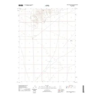
2020 Map of Desert Mountain Reservoir
USGS Topo · Published 2020About this map
Desert Mtn dominates the northern landscape of this Juab County quadrangle, where the high ground drops toward the arid drainage systems of the Great Basin. This 2020 survey highlights the essential role of water management in this desert environment, centered on the Desert Mountain Reservoir and the South Desert Mountain Reservoir. The terrain is defined by seasonal watercourses, including Cherry Cr and the Cherry Creek Wash, which carve through the basins south of the mountain slopes. Access to this remote region is facilitated by the Golden Hwy and a network of secondary routes like Desert Mountain Rd, which snake through the hills and service the local water infrastructure. The map provides a clear picture of the modern land divisions and topographical features that define this isolated stretch of the Utah desert.
Find a feature on this map
9 named features on this map. Tap any name to fly to it.
Don’t see what you’re looking for? This feature index may not catch every label — zoom into the map to look around manually.
Map Details
Editions of this 2020 Desert Mountain Reservoir Map
This is the sole edition of this map. No revisions or reprints were ever made.
Other maps of this area

1885 · Sevier Desert
USGS Topo · 1:250,000

1953 · Delta
USGS Topo · 1:250,000

1958 · Delta
USGS Topo · 1:250,000

1962 · Delta
USGS Topo · 1:250,000

1962 · Lynndyl
USGS Topo · 1:62,500

1963 · Cherry Creek
USGS Topo · 1:24,000

1971 · Baker Hot Springs
USGS Topo · 1:24,000

1971 · Rain Lake
USGS Topo · 1:24,000

1971 · Desert Mtn Pass
USGS Topo · 1:24,000

1971 · Crater Bench Reservoir
USGS Topo · 1:24,000