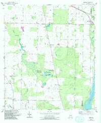
1954 Map of Desser
USGS Topo · Published 1993About this map
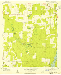
Lake Seminole dominates the southeastern corner of this landscape, its waters reaching toward the boundary between Seminole Co and Decatur Co. The terrain is defined by a complex network of sinkhole ponds and lakes, including Goose Lake, Shores Lake, and Cypress Lake. This 1954 survey, updated with 1988 photography, shows a rural community anchored by small crossroads and family landmarks. Local history is recorded in the names of Williams Cem, Trawick Cem, and Chason Cem, while the educational and civic life of the area is centered at the Rock Pond Sch and the nearby Rock Pond Courthouse. The settlement of Desser sits in the southwest, marked by a Lookout Tower, reflecting a period when fire observation and small-scale agriculture shaped the local economy. Springs like Spooner Springs and the flow of Spring Creek highlight the importance of the regional aquifer to this corner of Georgia.
Find a feature on this map
32 named features on this map. Tap any name to fly to it.
Don’t see what you’re looking for? This feature index may not catch every label — zoom into the map to look around manually.
Map Details
Editions of this 1954 Desser Map
3 editions found
Other maps of this area

1953 · Dothan
USGS Topo · 1:250,000

1954 · Dothan
USGS Topo · 1:250,000

1954 · Steam Mill
USGS Topo · 1:24,000

1954 · Desser
USGS Topo · 1:24,000

1954 · Tallahassee
USGS Topo · 1:250,000

1955 · Dothan
USGS Topo · 1:250,000

1955 · Fairchild
USGS Topo · 1:24,000

1955 · Reynoldsville
USGS Topo · 1:24,000

1955 · Bainbridge
USGS Topo · 1:62,500

1959 · Tallahassee
USGS Topo · 1:250,000