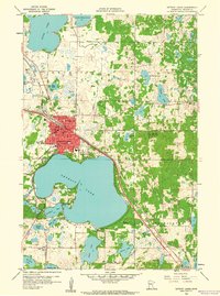
1959 Map of Detroit Lakes
USGS Topo · Published 1960About this map
Detroit Lakes serves as the focal point of this late 1950s survey, showing the community's development between the northern shore of Detroit Lake and the smaller Mud Lake. The town's layout is defined by the intersection of the Northern Pacific and the Minneapolis St Paul and Sault Ste Marie railroads, which facilitated its growth as a regional hub. Local educational infrastructure is well-represented with Washington Sch, Lincoln Sch, and the Jr High Sch all situated within the city grid, while Lake View Sch serves the southern outskirts.
Find a feature on this map
54 named features on this map. Tap any name to fly to it.
Don’t see what you’re looking for? This feature index may not catch every label — zoom into the map to look around manually.
Map Details
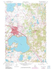
Editions of this 1959 Detroit Lakes Map
2 editions found
Other maps of this area

1912 · Vergas
USGS Topo · 1:62,500

1915 · Perham
USGS Topo · 1:62,500

1915 · Vergas
USGS Topo · 1:62,500

1953 · Brainerd
USGS Topo · 1:250,000

1957 · Brainerd
USGS Topo · 1:250,000

1958 · Brainerd
USGS Topo · 1:250,000

1959 · Flat Lake
USGS Topo · 1:24,000

1959 · Rochert
USGS Topo · 1:24,000

1959 · Richwood
USGS Topo · 1:24,000
1959 · Callaway
USGS Topo · 1:24,000