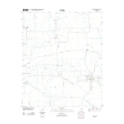
2013 Map of Detroit
USGS Topo · Published 2013About this map
The town of Detroit serves as the focal point of this northeast Texas landscape, situated along the eastern edge where several local routes and rail-aligned roads converge. The surrounding area is defined by a dense network of country roads, such as Walnut Ridge Rd and Farm Road 1502, connecting smaller rural clusters like Walnut Ridge, Post Oak, and Cross Road. This 2013 survey illustrates a landscape deeply etched by its creek systems, including Cuthand Cr and Wildcat Cr, which drain the agricultural land into the Denwiddie Bayou.
Find a feature on this map
71 named features on this map. Tap any name to fly to it.
Don’t see what you’re looking for? This feature index may not catch every label — zoom into the map to look around manually.
Map Details
Editions of this 2013 Detroit Map
This is the sole edition of this map. No revisions or reprints were ever made.
Other maps of this area

1951 · Slate Shoals
USGS Topo · 1:24,000

1951 · Woodland
USGS Topo · 1:24,000

1951 · Manchester
USGS Topo · 1:24,000

1953 · Texarkana
USGS Topo · 1:250,000

1956 · Texarkana
USGS Topo · 1:250,000

1964 · Detroit
USGS Topo · 1:24,000

1964 · Deport
USGS Topo · 1:24,000

1964 · Bagwell
USGS Topo · 1:24,000

1964 · Pattonville
USGS Topo · 1:24,000

1964 · Blossom
USGS Topo · 1:24,000