
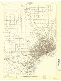
1905 Map of Detroit
USGS Topo · Published 1905About this map
The Detroit River serves as the focal point for this early 20th-century landscape, illustrating the intense concentration of industrial and transit infrastructure along the international border with Sandwich and Windsor. Dense street grids radiate from the riverfront, while the surrounding townships of Springwells, Greenfield, and Hamtramck show the early stages of suburban expansion. The map reveals a sophisticated network of electric railways, including the Detroit and Pontiac Line Electric Railway (Woodward Ave.) and the Detroit and Orchard Lake Electric Railway, which facilitated movement between the urban core and emerging settlements like Highland Park and Royal Oak. Large green spaces and memorial grounds such as Palmer Park, Forest Lawn Cemetery, and Mt Olivet Cemetery provide a distinct contrast to the heavy rail corridors of the Michigan Central R. R. and Pere Marquette R. R. that crisscross the region.
Find a feature on this map
56 named features on this map. Tap any name to fly to it.
Don’t see what you’re looking for? This feature index may not catch every label — zoom into the map to look around manually.
Map Details
Editions of this 1905 Detroit Map
2 editions found
Other maps of this area

1905 · Wayne
USGS Topo · 1:62,500

1905 · Grosse Pointe
USGS Topo · 1:62,500

1906 · Wyandotte
USGS Topo · 1:62,500

1906 · Romulus
USGS Topo · 1:62,500

1907 · Pontiac
USGS Topo · 1:62,500

1908 · Rochester
USGS Topo · 1:62,500

1912 · Mt Clemens
USGS Topo · 1:62,500

1912 · Wyandotte
USGS Topo · 1:62,500

1912 · Wayne
USGS Topo · 1:62,500

1918 · Detroit
USGS Topo · 1:62,500