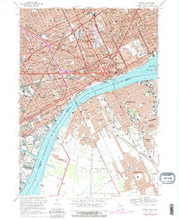
1968 Map of Detroit
USGS Topo · Published 1981About this map
The Detroit River serves as the central artery for this international crossing, linking industrial Detroit with Windsor. The landscape is dominated by the massive infrastructure of the mid-20th century, from the Ambassador Bridge and the Detroit-Windsor Tunnel to the expanding network of the Edsel Ford Freeway and Chrysler Freeway. On the Michigan side, the grid is punctuated by major landmarks like Tiger Stadium, Olympia Stadium, and the expansive grounds of Wayne State University.
Find a feature on this map
69 named features on this map. Tap any name to fly to it.
Don’t see what you’re looking for? This feature index may not catch every label — zoom into the map to look around manually.
Map Details
Editions of this 1968 Detroit Map
4 editions found
Other maps of this area

1905 · Detroit
USGS Topo · 1:62,500

1905 · Grosse Pointe
USGS Topo · 1:62,500

1906 · Wyandotte
USGS Topo · 1:62,500

1912 · Wyandotte
USGS Topo · 1:62,500

1918 · Detroit
USGS Topo · 1:62,500

1918 · Grosse Pointe
USGS Topo · 1:62,500

1924 · Detroit
USGS Topo · 1:62,500

1929 · Wyandotte
USGS Topo · 1:62,500

1934 · Detroit
USGS Topo · 1:62,500

1936 · Wyandotte
USGS Topo · 1:31,680