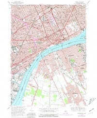
1968 Map of Detroit
USGS Topo · Published 1981About this map
Detroit and Windsor stand as industrial counterparts across the Detroit River in this detailed urban survey. The map documents the high density of the late 1960s city core, anchored by landmarks like Tiger Stadium and Wayne State University. Large medical complexes such as Ford Hospital, Grace Hospital, and Childrens Hospital occupy substantial city blocks, while the spiritual and educational life of the community is reflected in numerous neighborhood parochial schools, including St Anne Sch and Holy Redeemer High Sch.
Find a feature on this map
137 named features on this map. Tap any name to fly to it.
Don’t see what you’re looking for? This feature index may not catch every label — zoom into the map to look around manually.
Map Details
Editions of this 1968 Detroit Map
4 editions found
Other maps of this area

1905 · Detroit
USGS Topo · 1:62,500

1905 · Grosse Pointe
USGS Topo · 1:62,500

1906 · Wyandotte
USGS Topo · 1:62,500

1912 · Wyandotte
USGS Topo · 1:62,500

1918 · Detroit
USGS Topo · 1:62,500

1918 · Grosse Pointe
USGS Topo · 1:62,500

1924 · Detroit
USGS Topo · 1:62,500

1929 · Wyandotte
USGS Topo · 1:62,500

1934 · Detroit
USGS Topo · 1:62,500

1936 · Wyandotte
USGS Topo · 1:31,680