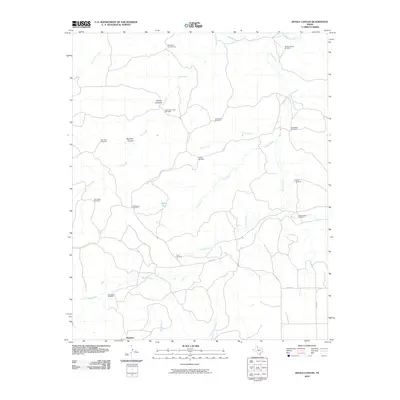
2010 Map of Devils Canyon
USGS Topo · Published 2010About this map
Narcisso sits at the southern edge of this West Texas landscape, where the drainage systems of the Tongue River and Middle Pease River carve a complex network of canyons and draws through the plains. The terrain is defined by dramatic geological features such as Devils Canyon and Red Hills Canyon, which interrupt the cattle-grazing country of Cottle County. This 2010 survey highlights a ranching economy dependent on dispersed water sources, evidenced by the high density of named landmarks like Turkey Tank and numerous cattle-tending stations.
Find a feature on this map
28 named features on this map. Tap any name to fly to it.
Don’t see what you’re looking for? This feature index may not catch every label — zoom into the map to look around manually.
Map Details
Editions of this 2010 Devils Canyon Map
This is the sole edition of this map. No revisions or reprints were ever made.
Other maps of this area

1954 · Lubbock
USGS Topo · 1:250,000

1954 · Plainview
USGS Topo · 1:250,000

1958 · Plainview
USGS Topo · 1:250,000

1966 · Fields Canyon
USGS Topo · 1:24,000

1966 · Cee Vee
USGS Topo · 1:24,000

1966 · Tee Pee City
USGS Topo · 1:24,000

1966 · Devils Canyon
USGS Topo · 1:24,000

1967 · Dunlap
USGS Topo · 1:24,000

1967 · Paducah
USGS Topo · 1:24,000

1968 · Grow NW
USGS Topo · 1:24,000