
1967 Map of Paducah
USGS Topo · Published 1970About this map
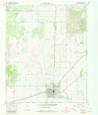
Paducah serves as the focal point of this Cottle County survey, showcasing a grid of residential and commercial streets typical of a mid-century Texas county seat. The Quanah Acme And Pacific railroad cuts a diagonal path through the landscape, linking the town to the broader region. To the south, the Garden of Memories (Cem) and a local Golf Course provide a detailed look at the community's organized spaces, while the north and west are defined by the sprawling Matador Wildlife Management Area. The terrain is marked by intermittent watercourses like Owl Creek and Shorty Creek, which drain toward more rugged breaks. Scattered infrastructure, such as the Fairberry Windmill and several Gravel Pits, reflects the local ranching and industrial activity. Transportation needs beyond the rail line are highlighted by the City-County Airfield and a remote Landing Strip, emphasizing the importance of aviation in this expansive territory.
Find a feature on this map
14 named features on this map. Tap any name to fly to it.
Don’t see what you’re looking for? This feature index may not catch every label — zoom into the map to look around manually.
Map Details
Editions of this 1967 Paducah Map
2 editions found
Other maps of this area

1954 · Lubbock
USGS Topo · 1:250,000

1954 · Plainview
USGS Topo · 1:250,000

1958 · Plainview
USGS Topo · 1:250,000

1966 · Cee Vee
USGS Topo · 1:24,000

1966 · Devils Canyon
USGS Topo · 1:24,000

1967 · Dunlap
USGS Topo · 1:24,000

1967 · Moons Camp
USGS Topo · 1:24,000
1967 · Swearingen
USGS Topo · 1:24,000
1968 · Chalk
USGS Topo · 1:24,000

1968 · Grow NW
USGS Topo · 1:24,000