
1967 Map of Moons Camp
USGS Topo · Published 1970About this map
Swearingen and Jacob sit along the path of the Quanah Acme and Pacific railroad, serving as primary anchors in this Cottle County landscape. The area is defined by its drainage systems, with Shorty Creek and Cottonwood Creek carving through the terrain toward the southeast. The infrastructure of the late 1960s is represented by a prominent Pipeline corridor and the remote Moons Camp settlement, suggesting a region focused on ranching and resource extraction. Evidence of local industry appears in the form of several Gravel Pits and a Drill Hole near the rail line. Landmarks like the Divide Windmill and Red Tower Windmill provide essential orientation points in an area where water management and transportation were the lifelines of the community.
Find a feature on this map
15 named features on this map. Tap any name to fly to it.
Don’t see what you’re looking for? This feature index may not catch every label — zoom into the map to look around manually.
Map Details
Editions of this 1967 Moons Camp Map
2 editions found
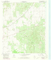
Other maps of this area

1954 · Lubbock
USGS Topo · 1:250,000

1954 · Plainview
USGS Topo · 1:250,000

1958 · Plainview
USGS Topo · 1:250,000

1967 · Dunlap
USGS Topo · 1:24,000

1967 · Triangle Ranch
USGS Topo · 1:24,000
1967 · Baker
USGS Topo · 1:24,000

1967 · Paducah
USGS Topo · 1:24,000
1967 · Swearingen
USGS Topo · 1:24,000

1968 · Y Ranch
USGS Topo · 1:24,000
1968 · Chalk
USGS Topo · 1:24,000