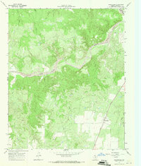
1967 Map of Swearingen
USGS Topo · Published 1970About this map
Swearingen serves as the primary focal point of this 1960s Cottle County survey, situated at a junction of the Quanah Acme and Pacific railroad in the southeastern corner of the map. The landscape is defined by the winding course of the Middle Pease River, which carves through the terrain to join the North Pease River at the northeastern edge. Numerous ephemeral waterways, including the curiously named Nasty Creek, Salt Creek, and Owl Creek, drain the surrounding breaks and uplands.
Find a feature on this map
15 named features on this map. Tap any name to fly to it.
Don’t see what you’re looking for? This feature index may not catch every label — zoom into the map to look around manually.
Map Details
Editions of this 1967 Swearingen Map
This is the sole edition of this map. No revisions or reprints were ever made.
Other maps of this area

1954 · Plainview
USGS Topo · 1:250,000

1958 · Plainview
USGS Topo · 1:250,000

1967 · Buckle L Ranch
USGS Topo · 1:24,000

1967 · Hell Roaring Creek
USGS Topo · 1:24,000

1967 · Kirkland South
USGS Topo · 1:24,000

1967 · Dunlap
USGS Topo · 1:24,000

1967 · Triangle Ranch
USGS Topo · 1:24,000
1967 · Baker
USGS Topo · 1:24,000

1967 · Paducah
USGS Topo · 1:24,000

1967 · Moons Camp
USGS Topo · 1:24,000