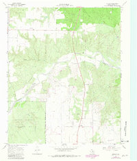
1967 Map of Dunlap
USGS Topo · Published 1981About this map
Dunlap stands at the intersection of Highways 82 and 83, serving as a central point in this Cottle County landscape during the late 1960s. The terrain is defined by the winding course of the Middle Pease River, which carves through the earth alongside Bluff Creek and Sweetwater Creek. This document captures the transition of the land into the Matador Wildlife Management Area, a significant conservation boundary that shapes the southwestern portion of the map.
Find a feature on this map
14 named features on this map. Tap any name to fly to it.
Don’t see what you’re looking for? This feature index may not catch every label — zoom into the map to look around manually.
Map Details
Editions of this 1967 Dunlap Map
2 editions found
Other maps of this area

1954 · Plainview
USGS Topo · 1:250,000

1958 · Plainview
USGS Topo · 1:250,000

1966 · Cee Vee
USGS Topo · 1:24,000

1966 · Devils Canyon
USGS Topo · 1:24,000

1967 · Buckle L Ranch
USGS Topo · 1:24,000

1967 · Tell South
USGS Topo · 1:24,000

1967 · Hell Roaring Creek
USGS Topo · 1:24,000

1967 · Dunlap
USGS Topo · 1:24,000

1967 · Paducah
USGS Topo · 1:24,000

1967 · Moons Camp
USGS Topo · 1:24,000