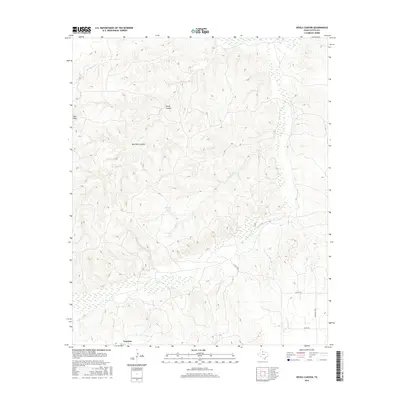
2016 Map of Devils Canyon
USGS Topo · Published 2016About this map
Narcisso sits at the southern edge of this West Texas landscape, serving as a primary point of reference in the transition from the rolling plains to the broken breaks of the Cottle County backcountry. The terrain is defined by a series of significant erosional features, most notably the deep relief of Devils Canyon and the prominent Red Hills. These features are carved by a network of seasonal watercourses, including Cow Hollow Cr, China Cr, and the winding path of Turkey Cr. In this arid environment, human activity and livestock management are evidenced by the presence of Turkey Tank, a critical water resource for the region. The map captures the intersection of natural topography and local transportation, showing the rural road network including Ranch Rd 1037 and several county routes that connect these remote ranchlands.
Find a feature on this map
15 named features on this map. Tap any name to fly to it.
Don’t see what you’re looking for? This feature index may not catch every label — zoom into the map to look around manually.
Map Details
Editions of this 2016 Devils Canyon Map
This is the sole edition of this map. No revisions or reprints were ever made.
Other maps of this area

1954 · Lubbock
USGS Topo · 1:250,000

1954 · Plainview
USGS Topo · 1:250,000

1958 · Plainview
USGS Topo · 1:250,000

1966 · Fields Canyon
USGS Topo · 1:24,000

1966 · Cee Vee
USGS Topo · 1:24,000

1966 · Tee Pee City
USGS Topo · 1:24,000

1966 · Devils Canyon
USGS Topo · 1:24,000

1967 · Dunlap
USGS Topo · 1:24,000

1967 · Paducah
USGS Topo · 1:24,000

1968 · Grow NW
USGS Topo · 1:24,000